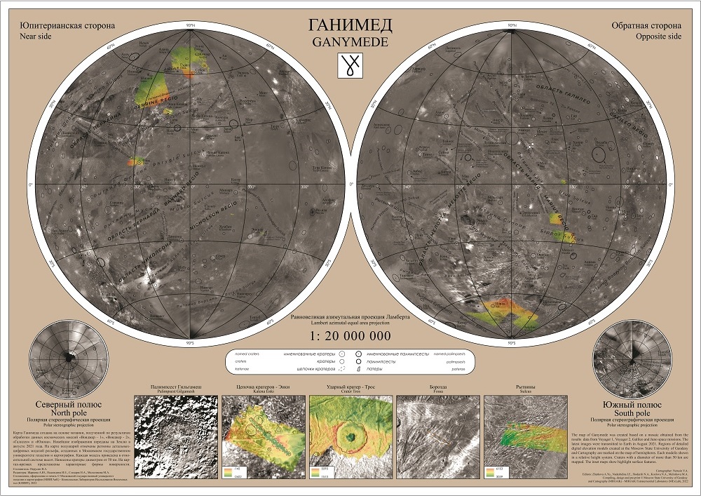
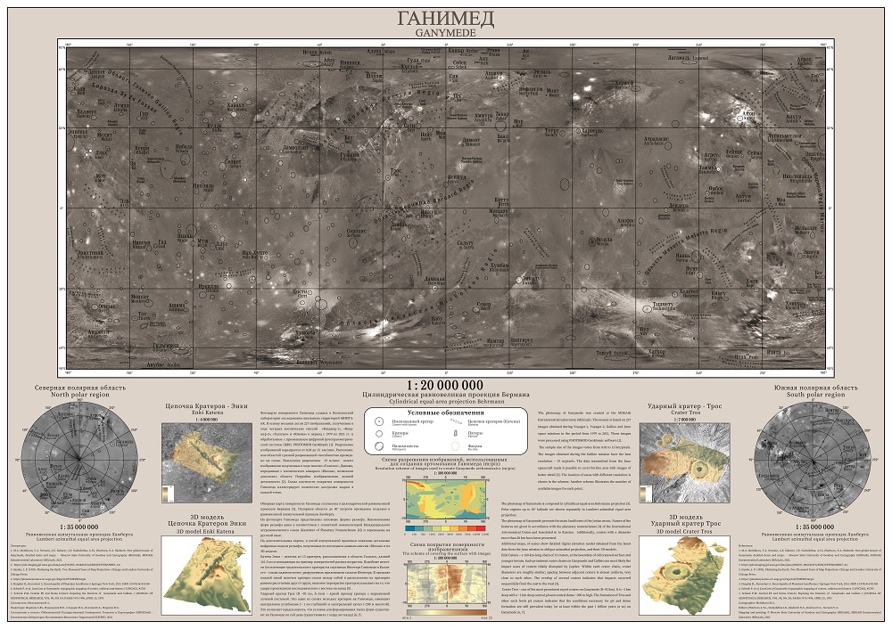
MIIGAiK Extraterrestrial Laboratory (MExLab) presents new wall maps of Ganymede. The Laboratory team performed joint processing of the best images of Ganymede provided by different space missions to Jupiter system – Voyager -1,2, Galileo and JUNO. Specially developed photogrammetric methods and PHOTOMOD software package made it possible to create a new control point network of Ganymede, which was used for proper orthorectification of images. The orthorectified images were compiled into the new photo map (mosaic), which became the basis for the two wall maps of Ganymede. Another important result of the work is presented on the maps – it is the new detailed digital terrain models (DTMs) for the territories of the crater Tros and crater chain Enki (Enki catena). This became possible thanks to images transmitted by the latest JUNO mission. Also, one of the maps shows the regions of detailed DEMs published earlier [1], while the other provides characteristics of the base mosaic generated at MExLab.
The authors of the maps, young cartographers V. Nerusin and M. Melnikova, completed this work as part of a summer practice [2]. Please feel free to send your comments or suggestions, or request detailed information and other products by contacting our Laboratory by email: mexlab@miigaik.ru.
1. A search for Ganymede stereo images and 3D mapping opportunities / A Zubarev, I Nadezhdina, E Brusnikin, B Giese, J Oberst. Planetary and Space Science 146, 40-54
2. New global mosaic of Ganymede, detailed dems and maps / M.A. Melnikova, V.A. Nerusin, A.E. Zubarev, I.E. Nadezhdina, A.Yu. Zharkova, N.A. Slodarzh Moscow State University of Geodesy and Cartography (MIIGAiK), MIIGAiK Extraterrestrial Laboratory (MExLab)


